
Cathy Manalo puts Filipinos on the map with geographical intelligence
Geoscientist Cathy Manalo leads Ulirat PH, aiming to digitize current maps and expand their functionalities by adding layers of environmental and social information beyond the geophysical.
Power structures are the zeitgeist of politics. Nations with deep histories of colonization like the Philippines have suffered from the long familiar shadow of colonial influences even in contemporary times, with indigenous rights and land reform being central issues. This unavoidably embeds itself in a multitude of sociopolitical contexts, resulting in serious and often chronic repercussions in the social fabric, affecting particularly vulnerable communities. Maps are no exception to this phenomenon.
Cathy Manalo is a geoscientist, an NGO worker, and is currently the Executive Director of Ulirat PH. She is at the forefront of illuminating and resolving these issues through the science of countermapping, bringing this movement closer to the Philippine geopolitical arena. “Countermapping is creating maps that challenge dominant structures”, Manalo says, adding that the concept was introduced by American scientist Nancy Peluso. “[Peluso] went to Indonesia where [she discovered that] government maps of forest areas undermine the rights of indigenous groups. In response, indigenous peoples would map their own communities, their spaces,” Manalo says.
Since then, it has been a critical organizing principle where maps that are generated by hegemonies, such as states and even academic canon, could be challenged by communities that are the ultimate stakeholders in these maps. In this process, geospatial information becomes more representative of the lived experiences of people and is closer to the realities on the ground. Ultimately, the fundamental goal is “asserting rights in contested spaces”, Manalo explains. “[Countermapping] is very participatory and my definition has evolved over time.”
Mapping Cathy Manalo
But what was the impetus behind Cathy’s eventual pioneering efforts in countermapping? That is to say, what was the map that led her to where she is now? Cathy started her scientific endeavors early on, with her interests in mathematics as a child and her participation in science projects as a Philippine Science High School student. Although she remarked that she was uncertain whether her career was indeed, mapping out to be in the sciences, she started out in the Geology program at the University of the Philippines – Diliman (UPD) at the National Institute of Geological Sciences (NIGS). During her undergraduate courses, her broad exposure to several aspects of science and its relationship with society sparked an interest that would eventually lead to pursuing a non-traditional path toward applying her degree.
“I found that I wanted to know more about the social side of science,” Cathy remarks.
Meandering through general education courses, she has deepdived into issues that led her to question hegemonies as they relate to geographical sciences. This inspired her to join mass organizations, where she participated in critical political discourse. “That’s when I realized the world was bigger than it was,” she says.
A formative experience that accelerated her current scientific journey was her work with the Junior Philippine Geographical society on a project that involved the hotly contested space of Sitio San Roque.
“For decades, NHA [National Housing Authority] and Ayala have formed a partnership that has caused the demolition and eviction of communities,” Cathy laments. “[As an example of countermapping], here’s a juxtaposition of two maps: Ayala used to regularly post new maps, with luxury, plain polygons that have a very “mabangong” description. Casinos, hotels and spaces for everyone—what’s not there in the map is the regular lives of the citizens.” This was her first experience with countermapping. The initiative delineated maps that included real elements of the daily lives of the residents of Sitio San Roque, such as their spaces of leisure, and these maps were then used to help assert their rights as residents.
Ulirat Collective
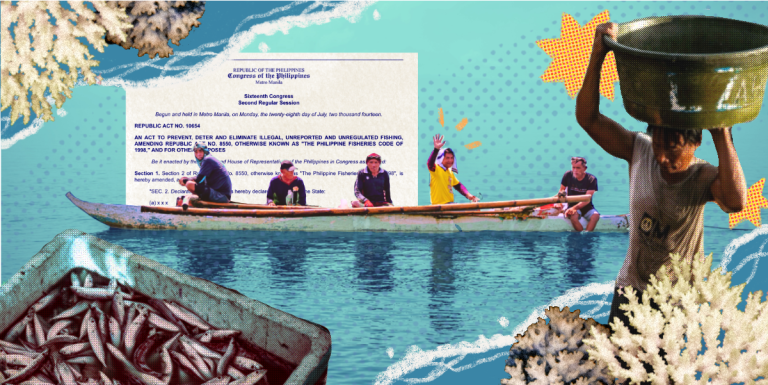
Today, Cathy Manalo is an NGO worker and mapper, working on a countermapping initiative known as Ulirat Collective. She is currently spearheading the MinaMapa project, where a large collection of volunteers which include geospatial specialists, social scientists, and community organizers synergize their expertise in an effort to provide a comprehensive map of mining in the Philippines. They aim to digitize current maps to render them editable and overlay them onto other environmental and social layers of information, a feature that is widely unavailable in government-procured maps.
The organization started from scratch. When asked to detail the process, Cathy paints a picture involving “growing pains, organizing people, seeking resources, finding an identity as an organization, and [ensuring they] have impact on society in general.”
“Our goal is to make a dashboard of these maps, to reach communities who are affected by mining as well as environmental organizations for environmental protection. Currently, [the Philippine] government doesn’t provide vector files of mining—[what’s called] editable shapefiles. They [consequently] can’t show how it affects communities”, Cathy explains.
“Countermapping has an aggressive show of politicality [and] should always be done with and by the communities,” she adds. “We’re dealing with questioning power structures. Maps can really change views eh. They have the power to change our opinions—accept realities or deny realities.”
The MinaMapa project obtains important feedback from indigenous communities as stakeholders on how they can use these digitized maps to reinforce their rights as citizens of these contested spaces. “Why don’t we have better quality maps? Why do our [government] maps have [mining] tenements overlapping with protected areas and watersheds?” Cathy adds. Initiatives like MinaMapa may be key to addressing these geospatial problems. They can provide data that bridge these gaps, that then better incorporates the welfare of the community and allows them to contest initiatives that may be detrimental to the residents as well as the environment. “No, we don’t accept the maps that they show us. We want to put ourselves in the maps. We want to fill in those shapes,” Cathy says.
Bridging two opposing forces
With the nature of the Ulirat Collective, Cathy and her team have to be careful when presenting their work. The threat of being tagged as a group working against the government looms when established power structures are being called into question. Cathy stresses that that is not the purpose of Ulirat. “We’re not going against the government, we are giving suggestions,” particularly ones that give local communities a seat at the table.
Cathy notes that what makes countermapping special is that it strikes a balance between two voices in civil society that don’t often see eye to eye. On one side are the groups working in STEM who are, as Cathy puts it, “not always aware of the social realities on the ground.” On the other side are the NGO groups who work with society, but can at times be intimidated by the scientific method. “Marami pa ring NGOs [who struggle with] science [and] don’t always include scientists in the conversation. When you question the methodology, you can be accused of not believing [in] the cause.”
While this divide has been a roadblock for Ulirat, they maintain that bridging these two sides is the way forward. Cathy suggests that people working with the community should create more avenues for scientists to participate in their projects, while people working in STEM should make communication simpler with less jargon so communities will not feel too intimidated to engage with them. It is through this dialogue and exchange of ideas that Cathy believes Ulirat can achieve its goal to create maps that are “not just scientifically correct, but [also] make a statement.”
Anyone can countermap!
While Cathy’s background in geology and geography gives her a uniquely technical perspective, she doesn’t consider herself a “scientist with a capital S”. She puts her STEM degree to use, but sees herself as more of “an NGO worker who practices countermapping.”
Ulirat emphasizes the need to promote collective action, and not just among people with degrees in geology. Cathy likens their philosophy to that of the 2007 film Ratatouille. “In Ratatouille, Gusteau always says ‘anyone can cook.’ [Similarly], in Ulirat, we believe everyone can map.” She hopes that this is the impact they make on Philippine society, reiterating Ulirat’s mission to “catalyze social action by channeling geographical intelligence.”